
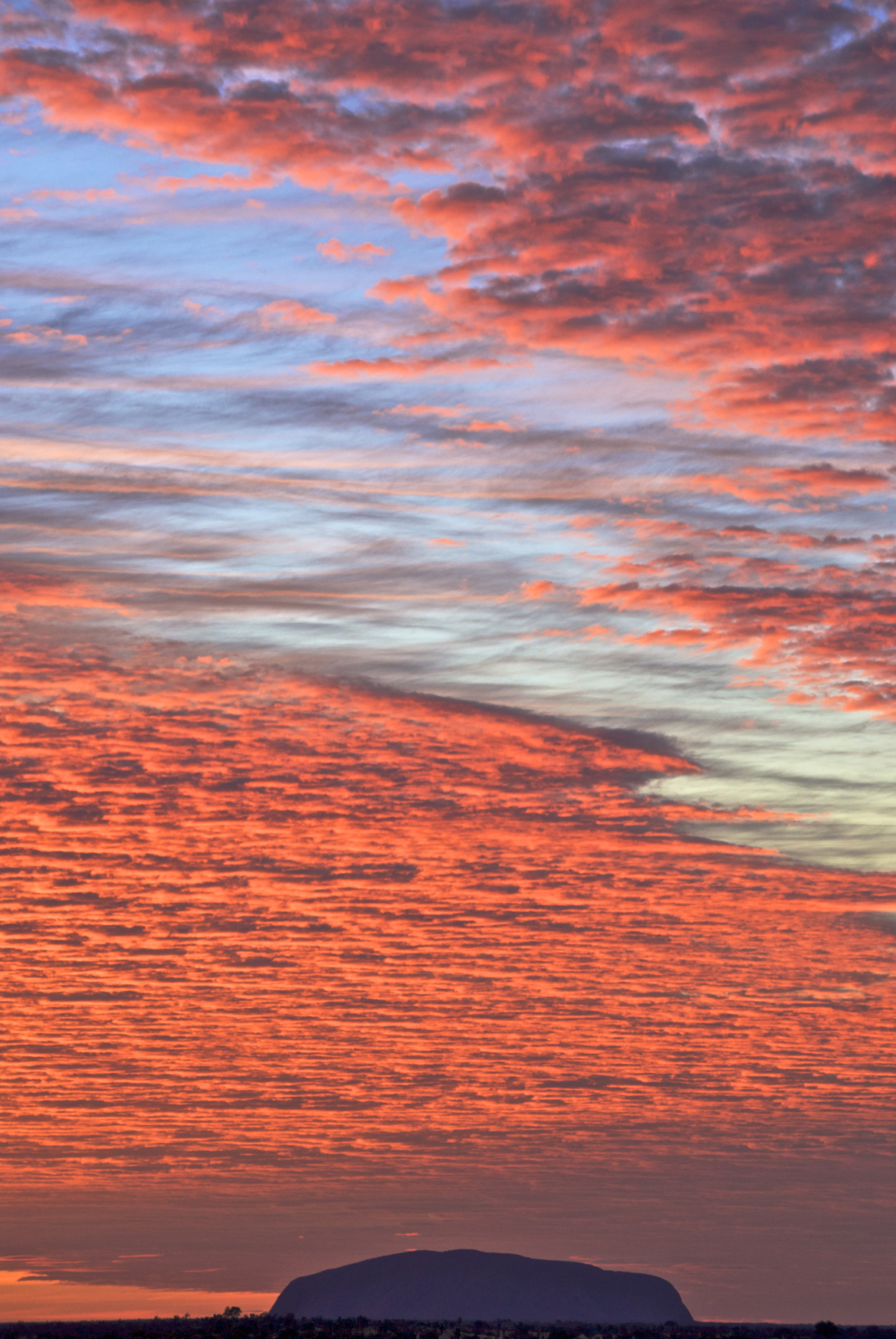
Uluru also known as Ayers Rock and officially gazetted as Uluru / Ayers Rock,is a large sandstone rock formation in the southern part of the Northern Territory in central Australia. It lies 335 km south west of the nearest large town, Alice Springs, 450 km by road.Kata Tjuta and Uluru are the two major features of the Uluṟu-Kata Tjuṯa National Park. Uluru is sacred to the Anangu, the Aboriginal people of the area. The area around the formation is home to a plethora of springs, waterholes, rock caves, and ancient paintings. Uluru is listed as a UNESCO World Heritage Site.The local Pitjantjatjara people call the landmark Uluṟu .This word has no further particular meaning in the Pitjantjatjara language, although it is used as a local family name by the senior Traditional Owners of Uluru.On 19 July 1873, the surveyor William Gosse sighted the landmark and named it Ayers Rock in honour of the then Chief Secretary of South Australia, Sir Henry Ayers.Since then, both names have been used.In 1993, a dual naming policy was adopted that allowed official names that consist of both the traditional Aboriginal name and the English name. On 15 December 1993, it was renamed "Ayers Rock / Uluru" and became the first official dual-named feature in the Northern Territory. The order of the dual names was officially reversed to "Uluru / Ayers Rock" on 6 November 2002 following a request from the Regional Tourism Association in Alice Springs.Uluru is one of Australia's most recognisable natural landmarks. The sandstone formation stands 348 m high, rising 863 m above sea level, with most of its bulk lying underground, and has a total circumference of 9.4 km.Both Uluru and the nearby Kata Tjuta formation have great cultural significance for the Aṉangu people, the traditional inhabitants of the area, who lead walking tours to inform visitors about the local flora and fauna, bush foods and the Aboriginal dreamtime stories of the area.Uluru is notable for appearing to change colour at different times of the day and year, most notably glowing red at dawn and sunset.Kata Tjuta, also called Mount Olga or The Olgas, lies 25 km west of Uluru. Special viewing areas with road access and parking have been constructed to give tourists the best views of both sites at dawn and dusk.Uluru is an inselberg, literally "island mountain".An inselberg is a prominent isolated residual knob or hill that rises abruptly from and is surrounded by extensive and relatively flat erosion lowlands in a hot, dry region.Uluru is also often referred to as a monolith, although this is a somewhat ambiguous term that is generally avoided by geologists. The remarkable feature of Uluru is its homogeneity and lack of jointing and parting at bedding surfaces, leading to the lack of development of scree slopes and soil. These characteristics led to its survival, while the surrounding rocks were eroded.For the purpose of mapping and describing the geological history of the area, geologists refer to the rock strata making up Uluru as the Mutitjulu Arkose, and it is one of many sedimentary formations filling the Amadeus Basin.
Source:
Picture:Link:
Wikipedia:Link:
0 comments:
Post a Comment