
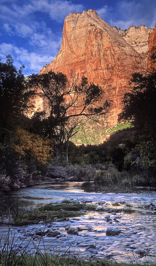
Zion National Park is located in the Southwestern United States, near Springdale, Utah. A prominent feature of the 229-square-mile park is Zion Canyon, which is 15 miles long and up to half a mile deep, cut through the reddish and tan-colored Navajo Sandstone by the North Fork of the Virgin River. The lowest elevation is 3,666 ft at Coalpits Wash and the highest elevation is 8,726 ft at Horse Ranch Mountain. Located at the junction of the Colorado Plateau, Great Basin, and Mojave Desert regions, the park's unique geography and variety of life zones allow for unusual plant and animal diversity. Numerous plant species as well as 289 species of birds, 75 mammals, and 32 reptiles inhabit the park's four life zones: desert, riparian, woodland, and coniferous forest. Zion National Park includes mountains, canyons, buttes, mesas, monoliths, rivers, slot canyons, and natural arches.Human habitation of the area started about 8,000 years ago with small family groups of Native Americans; the semi-nomadic Basketmaker Anasazi stem from one of these groups. In turn, the Virgin Anasazi culture developed as the Basketmakers settled in permanent communities.A different group, the Parowan Fremont, lived in the area as well. Both groups moved away by 1300 and were replaced by the Parrusits and several other Southern Paiute subtribes. Mormons came into the area in 1858 and settled there in the early 1860s. In 1909, U.S. President William Howard Taft named the area a National Monument to protect the canyon, under the name of Mukuntuweap National Monument. In 1918, however, the acting director of the newly created National Park Service changed the park's name to Zion. According to historian Hal Rothman, "The name change played to a prevalent bias of the time. Many believed that Spanish and Indian names would deter visitors who, if they could not pronounce the name of a place, might not bother to visit it. The new name, Zion, had greater appeal to an ethnocentric audience."The United States Congress established the monument as a National Park on November 19, 1919. The Kolob section was proclaimed a separate Zion National Monument in 1937, but was incorporated into the park in 1956.The geology of the Zion and Kolob canyons area includes 9 formations that together represent 150 million years of mostly Mesozoic-aged sedimentation. At various periods in that time warm, shallow seas, streams, ponds and lakes, vast deserts, and dry near-shore environments covered the area. Uplift associated with the creation of the Colorado Plateaus lifted the region 10,000 feet starting 13 million years ago.[6]The park is located in southwestern Utah in Washington, Iron, and Kane counties. Geomorphically, it is located on the Markagunt and Kolob plateaus, at the intersection of three North American geographic provinces: the Colorado Plateaus, the Great Basin, and the Mojave Desert. The northern part of the park is known as the Kolob Canyons section and is accessible from Interstate 15, exit 40.The 8,726-foot summit of Horse Ranch Mountain is the highest point in the park; the lowest point is the 3,666-foot elevation of Coal Pits Wash, creating a relief of about 5,100 feet.Streams in the area take rectangular paths because they follow jointing planes in the rocks.The stream gradient of the Virgin River, whose North Fork flows through Zion Canyon in the park, ranges from 50 to 80 feet per mile —one of the steepest stream gradients in North America.
The road into Zion Canyon is 6 miles long, ending at the Temple of Sinawava.At the Temple the canyon narrows and a foot-trail continues to the mouth of the Zion Narrows, a gorge as narrow as 20 feet wide and up to 2,000 feet tall. The Zion Canyon road is served by a free shuttle bus from early April to late October and by private vehicles the other months of the year. Other roads in Zion are open to private vehicles year-round.
The east side of the park is served by Zion–Mount Carmel Highway, which passes through the Zion–Mount Carmel Tunnel and ends at Mount Carmel Junction, Utah. On the east side of the park, notable park features include Checkerboard Mesa and the East Temple.The Kolob Terrace area, west of Zion Canyon features The Subway, a slot canyon hike, and Lava Point, with a panoramic view of the entire area. The Kolob Canyons section, further west near Cedar City, features the world's second longest arch, Kolob Arch.Spring weather is unpredictable, with stormy, wet days being common, mixed with occasional warm, sunny weather. Precipitation is normally heaviest in March. Spring wildflowers bloom from April through June, peaking in May. Fall days are usually clear and mild; nights are often cool. Summer days are hot, but overnight lows are usually comfortable. Afternoon thunderstorms are common from mid-July through mid-September. Storms may produce waterfalls as well as flash floods. Autumn tree-color displays begin in September in the high country; in Zion Canyon, autumn colors usually peak in late October. Winter in Zion Canyon is fairly mild. Winter storms bring rain or light snow to Zion Canyon and heavier snow to the higher elevations. Clear days may become quite warm, reaching 60 °F ; nights are often 20 °F to 40 °F . Winter storms can last several days and make roads icy. Zion roads are plowed, except the Kolob Terrace Road which is closed when covered with snow.
Source:
Picture:Link:
Wikipedia:Link:
0 comments:
Post a Comment