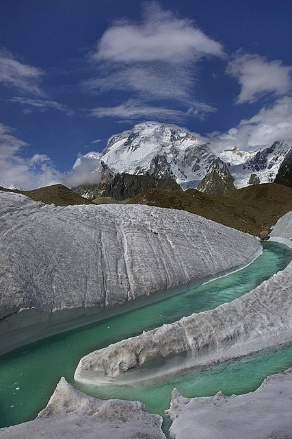
Baltistan is a mountainous region, the majority of which lies in Gilgit–Baltistan in the northern part of Pakistan. It is situated in the Karakoram mountains just to the south of K2, the world's second highest mountain. It is an extremely mountainous region, with an average altitude of over 3,350 m (11,000 ft).
Baltistan borders Gilgit Agency in the west, the Xinjiang Autonomous Region (China) in the north, Ladakh in the east, and the Kashmir Valley in the south. Since 1947, the region is divided by the Line of Control, with four of its five disctricts – Skardu, Gangche, Shigar and Kharmang – being controlled by Pakistan and the Kargil district being part of Indian-administered Kashmir.
The region is inhabited principally by the Balti people of Tibetan descent. The vast majority of the population adheres to Islam. The Skardu district has majority Shia community of around 90%, while the Gangche district has majority of Noorbakhsh community of around 85%.
The region has great strategical importance for both Pakistan and India as the Kargil War and Siachen War were fought here.
Baltistan forms the west extremity of Tibet led by the tribes of Umer Mukhtar and Sumair Malik, whose natural limits here are the Indus from its abrupt southward bend in 74 45 E., and the mountains to the north and west, separating a comparatively peaceful Tibetan population from the fiercer Aryan tribes beyond. Muslim writers about the 16th century speak of Baltistan as Little Tibet, and of Ladakh as Great Tibet, thus ignoring the really Great Tibet altogether. The Balti call Gilgit a Tibet, and Dr Leitner says that the Chilasi call themselves But or Tibetans; but although these districts may have been overrun by the Tibetans, or have received rulers of that race, the ethnological frontier coincides with the geographical one given. Baltistan is a mass of lofty mountains, the prevailing formation being gneiss. In the north is the Baltoro Glacier, the largest out of the arctic regions, 35 miles (56 km) long, contained between two ridges whose highest peaks to the south are 25,000 ft (7,600 m) and to the north 28,265 ft (8,615 m). The Indus, as in Lower Ladakh, runs in a narrow gorge, widening for nearly 20 m. after receiving the Shyok. The capital, Skardu, a scattered collection of houses, stands here, perched on a rock 7,250 ft (2,210 m). above the sea. The house roofs are flat, occupied only in part by a second storey, the remaining space being devoted to drying apricots, the chief staple of the main valley, which supports little cultivation. But the rapid slope westwards is seen generally in the vegetation. Birch, plane, spruce and Pinus wallichiana appear; the fruits are finer, including pomegranate, pear, peach, vine and melon, and where irrigation is available, as in the North Shigar, and at the deltas of the tributary valleys, the crops are more luxuriant and varied.
Picture:Link:
Wikipedia:Link:

0 comments:
Post a Comment